
Airstrip Junkies
|
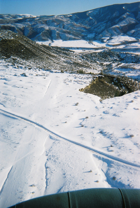
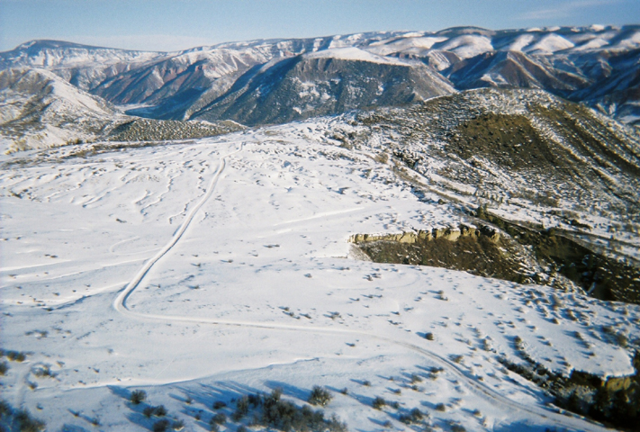
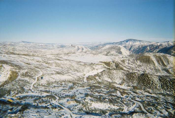
Aspen Gliderport (CO03) – Aspen, Colorado
 There
is no specific information obtained on this strip. The Flight
Simulator shows the airstrip sits on top of a bluff about a mile or
so northwest of the main Aspen airport. Airnam reports "airport
closed until further notice." It has been there for many years and
is probably overrun with vegetation.
There
is no specific information obtained on this strip. The Flight
Simulator shows the airstrip sits on top of a bluff about a mile or
so northwest of the main Aspen airport. Airnam reports "airport
closed until further notice." It has been there for many years and
is probably overrun with vegetation.
 From
Ned Carter, Aspen: It is more or less still there.
A bit overgrown, but one heck of a
place for a simulated engine failure.
Ha
ha. There is also John McBrides' grass
strip in Old Snowmass, then southwest of
Carbondale there is another strip that is closed, but in an
emergency...any kind of flat area will do. Then of course there is
the Marble grass strip.
From
Ned Carter, Aspen: It is more or less still there.
A bit overgrown, but one heck of a
place for a simulated engine failure.
Ha
ha. There is also John McBrides' grass
strip in Old Snowmass, then southwest of
Carbondale there is another strip that is closed, but in an
emergency...any kind of flat area will do. Then of course there is
the Marble grass strip.
Photos by Colin Graham
Any info e-mail Colin Graham - colingraham@endeavorballoon.com
Athanasiou Valley – Central City, Colorado
Private / James Athanasiou
Elevation 8,900
CO07- Athanasiou Valley airstrip is an 'emergency use only' airstrip. It has not been used in over 30 years according to it’s owner. He claims to have kept it on the charts for emergency use only. He did not say whether anyone has had to use it or not. He went on to say it’s a big field and full of weeds, 2000-feet long and about 200-feet wide, at an elevation of 8,900 feet. One of America’s highest airstrips, aging in the Front Range winds. For all intents and purposes, this airstrip is closed and you’ll be better off considering it as such.
No Images Available
Barker Creek Ranch, NV31
Round Mountain, Nevada
Elevation 6,600
Strictly Private / C. Coleman
NV31 - Located about 6 miles north of Round Mountain, Nevada. The Barker Creek Ranch airstrip sits awaiting its only pilot and owner to once again fly. The runway is in poor condition and is a chip-seal surface extending for 1,350 feet at an elevation of 6,600 feet – one of Nevada's higher airstrips.
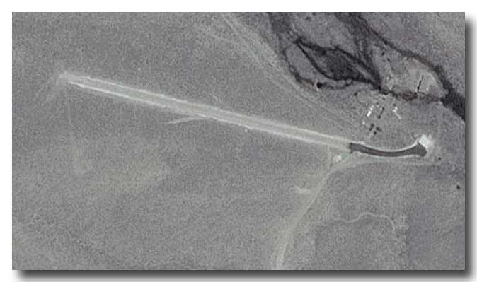 It
lies on the east side of Big Smoky Valley and has a 7.5-percent
grade to the east. Again, it is one-way in, one-way out. The owner
points out the grade equals about 4.5 degrees off flat. He also
calims simply that "it's VERY steep." Mr Coleman has never let
anyone else land here and doesn't plan on doing so in the future due
to the dangerous nature of the airstrip. There is absolutely no
go-around. You either plant it on the firs try or you 'bite the
dust.' (Satellite image - click to enlarge)
It
lies on the east side of Big Smoky Valley and has a 7.5-percent
grade to the east. Again, it is one-way in, one-way out. The owner
points out the grade equals about 4.5 degrees off flat. He also
calims simply that "it's VERY steep." Mr Coleman has never let
anyone else land here and doesn't plan on doing so in the future due
to the dangerous nature of the airstrip. There is absolutely no
go-around. You either plant it on the firs try or you 'bite the
dust.' (Satellite image - click to enlarge)
Big Island – Orofino, Idaho
Elevation 2,200
Private / C.P.T.P.A.
 ID29
This airstrip is one of three owned by a company called Clearwater Potlach Timber Protective Association (www.cptpa.com). They are
trying to clear underbrush to stop the many forest fires from
devastating the North Central Idaho wilderness. This airstrip lies
on a bluff about 1,000 feet over the Dworshak Reservoir. They own
two other airstrips and own leasing rights to another, all within 30
miles from each other. Big Island is about 2,600 feet in length,
downhill and mainly dirt. It has a rather dangerous approach and it
is advised that one should land to the north and take off to the
south.
ID29
This airstrip is one of three owned by a company called Clearwater Potlach Timber Protective Association (www.cptpa.com). They are
trying to clear underbrush to stop the many forest fires from
devastating the North Central Idaho wilderness. This airstrip lies
on a bluff about 1,000 feet over the Dworshak Reservoir. They own
two other airstrips and own leasing rights to another, all within 30
miles from each other. Big Island is about 2,600 feet in length,
downhill and mainly dirt. It has a rather dangerous approach and it
is advised that one should land to the north and take off to the
south.
Check www.cptpa.com and ask for the chief pilot. They may or may not give you permission.
Coyote Flats USFS – Bishop,
California
9,989 elevation
Private / Closed
04CA Located at N37.2, W118.48 west of Bishop, California. Resting high above Bishop at an elevation of nearly 10,000 feet is Coyote Flats. Two years ago the National Park Service tore it up, but people still land on what remains. The history is a bit interesting. It was built in the 69s as a military high-altitude training airport for helicopters and airplanes.
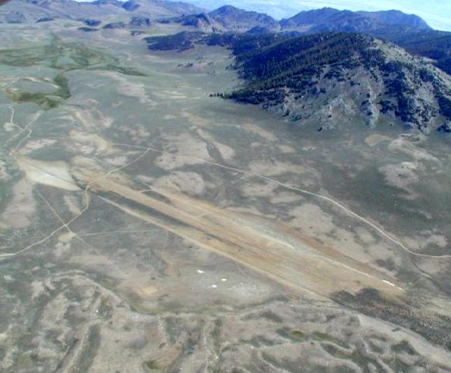 Photo
by James D Lawson (click to enlarge)
Photo
by James D Lawson (click to enlarge)
When active it was 3,000 feet of paved asphalt. To the east the earth drops 6,000 feet into the valley. To the west it climbs to more than 13,500 feet into Kings Canyon National Park. Awesome.
Talk to some local pilots in Bishop if you still want to try this strip. The Forest Service dug deep ruts across the runway but someone filled them in and the runway is dirt and in pretty good condition.
It is "closed," but not closed. There
are "X" markers on each end. I do not promote the use of the
airstrip. Any usage is at your own risk.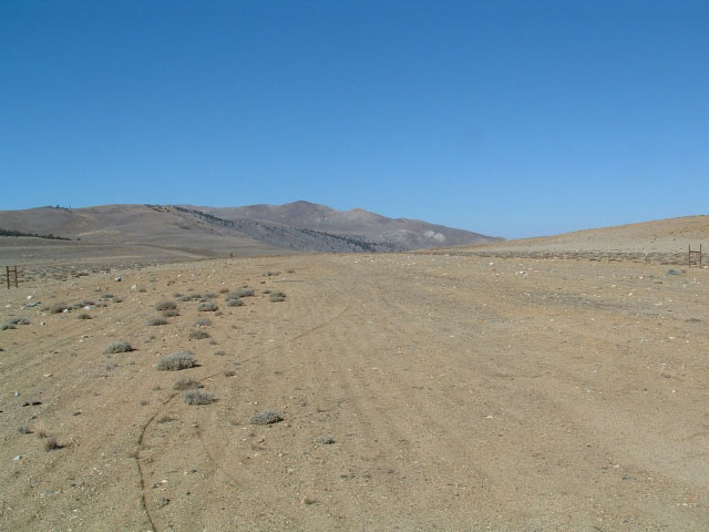
I visited Coyote Flats on October 30,
2005 around 11:00 PST. The OAT was 42ºF and the wind was from the
north at 5 knots. There was a good accumulation of small clumps of
vegetation
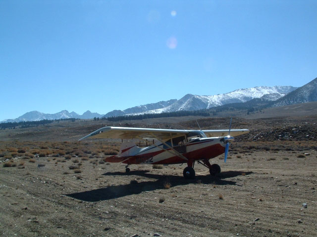 growing
along the runway, and some small rock on the runway. The useful
length is diminished by the Xs (made from cantaloupe-size rocks).
There is sufficient runway that I had no problem getting in and out
of there in my Maule M4-220C with 8.50x6 mains. I was my myself with
about 3/4 fuel.
growing
along the runway, and some small rock on the runway. The useful
length is diminished by the Xs (made from cantaloupe-size rocks).
There is sufficient runway that I had no problem getting in and out
of there in my Maule M4-220C with 8.50x6 mains. I was my myself with
about 3/4 fuel.
Avion Club (at Buckhorn Ranch) –
Crested Butte, Colorado
8,980 elevation
Public
0CO2 This airstrip is also unique (aren't they all?). It sits as one of the nation's highest airports at 8,980 feet. It is publicly owned and run by a man named Carlo Cesa. I assure you this man is "way too cool." He even offered me a plane ride when he was in Albuquerque while I was taking my commercial exams.
The last couple of years saw the strip freshly paved to 4,400 feet. It is very nice and there is not much of a problem getting airborne. Watch the density altitude. The airstrip is being threatened for closure by a housing developer who wants to make a road across the runway.
Beaverhead Airstrip
North of Silver City, NM
6,750 elevation
Public
Located 9 miles NW of Me-Own and about 40 miles north of Silver City, this airstrip serves the Beaverhead Ranger Station ... about two miles away. It is within the Black Ranger District. The single dirt runway (12/30) is very well maintained and used on a regular basis by the USFS. It is located on top of a mesa with a length of 3,840-feet and 50-feet wide. Surrounding terrain is juniper trees with plenty of aircraft parking available. The airport is open to the public, with a windsock but no other facilities.
Charlie, USFS, 505-536-2250 informed us that for the most part all approaches are open but the terrain begins to rise to the southwest of the airport. Notify other traffic of intentions on 120.750.
|
|
|