
Idaho Airstrips - Wilson Bar
WARNING! The information presented about the Idaho Airstrips is not intended to replace flight instruction from a competent instructor for flying to or landing at any of the airstrips presented. DONOT attempt to land at Wilson Bar until you have received instruction on the proper approach and short-field landings. The airstrip will not be visible until about a 1/4-mile final. Although much information may be presented, it is not sufficient to cover all the hazards associated with these backcountry airstrips.
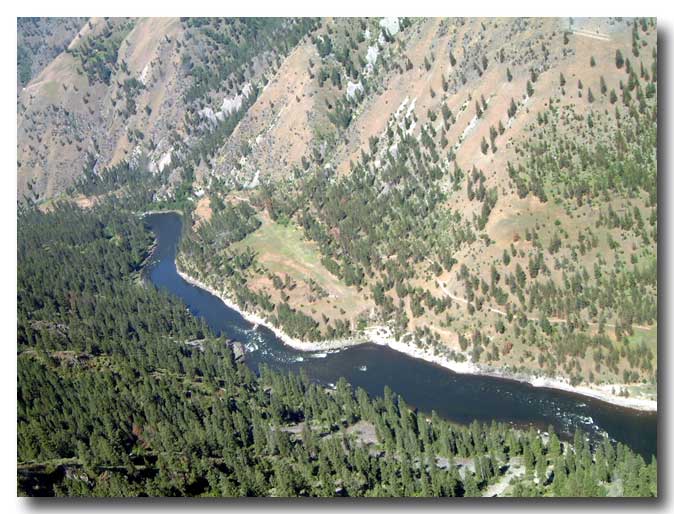
Wilson Bar Airstrip is located on the north side of the Salmon River about 2.7-miles northeast of the confluence of the Salmon River and the South Fork of the Salmon River.
Name: Wilson Bar
Identifier: None
Elevation: 2,250 feet
Lat: N45-23.80 Long: W115-29.00
Surface: Turf
Runway: 6/24
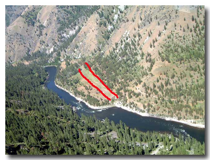
Length & width: 1,500 feet by 50 feet
Remarks: Recommend landing downstream
(uphill) runway 24, depart upstream runway 6. Mackey Bar
airstrip is located 2-miles downstream (southwest – to the left in
this picture).
It is difficult to gain an appreciation of the approach and the upslope of runway 24 from the photos. Once the airplane turns final for runway 24, this becomes a one-way airstrip.
Before beginning the descent, look at the location of the airstrip. Use everything available as cues for your arrival. You will note there is a large area of obstructions in the river causing ripples and white water across most of the river. Before reaching the strip there is another area of ripples and white water. The airstrip is after the "small" ripples and before the "large" ripples.
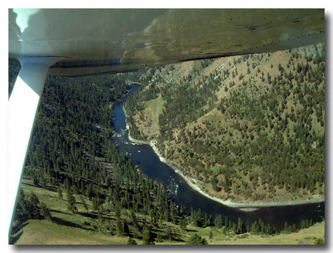
The approach is generally started from near where this photo was taken. The airplane descends to the north on the east side of the ridge. The airstrip will not be visible during the approach. Clear the area and make an announcement on 122.9 MHz prior to initializing the approach. After making a left, descending turn, the shale rocks (bottom left one third of photo) are used as an aiming point. The airplane continues the approach. The strip has not been in view since shortly after the start of the approach.
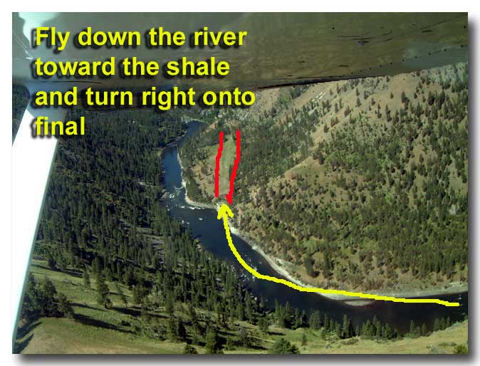
If it has been impossible to lose the altitude by the time the airplane reaches the Salmon River, continue flying up river until the desired altitude has been achieved. The airport elevation is 2,250 feet. The airstrip will not become visible until on a 1/4-mile final (or less). Use the rule that if the airplane is 1,000-feet AGL at 1 mile from the airport, it would be 500-feet AGL at 1/2 mile, and 250-feet AGL at 1/4 mile. Maybe an altitude of 2,500 feet will work to fly down the Salmon River.
As you round a bend in the river you will have a straight shot toward an area of shale slides on the south side of the river (near the beginning of the yellow arrow). The river curves to the right. Stay on the left side to allow more room for turning final. You might get a little apprehensive as you continue, trying to find the airstrip. Remember your cues, after the "little" water falls and before the "big" water falls.
 Approaching Wilson Bar from the west. Mackey Bar is visible in the foreground. |
 Mackey Bar airstrip, about 2 miles downstream from Wilson Bar. |
 Depart runway 6, land runway 24 (on right). |
 Flying beyond the airstrip and crossing over the ridge to the east. |
 Note the relation of the airstrip to the rippled water. When following the river, pass the first ripples and turn final at the second ripples. |
 Drop down and follow the Salmon River downstream toward the west. |
 Continue following the river. |
 Continuing along the river. |
 The ripples are visible. |
 Fly
beyond the first set of ripples. Fly
beyond the first set of ripples. |
 Approaching
the second set of ripples. Approaching
the second set of ripples. |
 Turn
final approach at the second set of ripples. Turn
final approach at the second set of ripples. |
 Landing on runway 24. |
 On runway 24. The windsock is on the left. |
 Continuing the rollout on runway 24. |
 Parking at approach end of runway 6. |
 Might be a good idea to turn the fuel selector off to prevent siphoning of fuel if the airplane is parked on a slope for any amount of time. CAUTION: Consider placing a glove, socks, or tie a scarf around the throttle as a reminder to turn the fuel back ON. |
 Runway 6 is used for departure. After takeoff, turn left and follow the Salmon River upstream. |
|
|
|