Airstrip Junkies
by Colin M. Graham
Elevation 6,500
 25U
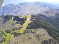
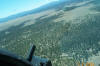
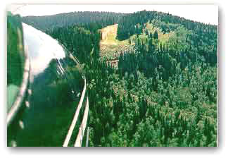
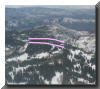
Memaloose is another good strip for those looking for a
little adventure. It is nestled 6,500 feet above the raging
Snake River and Hells Canyon National Recreation Area. Some
pilots elect to fly in from the south while others prefer
the north. Memaloose is currently owner and maintained by
the forestry service. Be careful with downdrafts over the
edge on the south side. It is a 4,000-foot sheer drop. 25U
Memaloose is another good strip for those looking for a
little adventure. It is nestled 6,500 feet above the raging
Snake River and Hells Canyon National Recreation Area. Some
pilots elect to fly in from the south while others prefer
the north. Memaloose is currently owner and maintained by
the forestry service. Be careful with downdrafts over the
edge on the south side. It is a 4,000-foot sheer drop.
Wallowa-Whitman National Forest
P.O. Box 907
Baker City, Oregon 97814
503-523-6391
Looking at Memaloose from the north
Elevation 5,800
 Mile Hi. The name says it all. This strip is
deep in the Frank Church River of No Return Wilderness in
the middle of Idaho's backcountry. It rests about 1,500 feet
over Big Creek as it meanders into the Middle Fork of the
Salmon 15 miles downstream. It is definitely one-way in and
one-way out. At only 500 feet usable length it not for the
light hearted. It has a 30-percent uphill slope to make your
heart pump even faster. Mile Hi. The name says it all. This strip is
deep in the Frank Church River of No Return Wilderness in
the middle of Idaho's backcountry. It rests about 1,500 feet
over Big Creek as it meanders into the Middle Fork of the
Salmon 15 miles downstream. It is definitely one-way in and
one-way out. At only 500 feet usable length it not for the
light hearted. It has a 30-percent uphill slope to make your
heart pump even faster.
The strip is suited for taildragger aircraft
such as a Piper Cub, Super Cub, Maule, Cessna 180 or Cessna
185. Elevation is about 5,800 feet. Pictures can be seen in
Galen Hanselman's book "FLY IDAHO!" Many thanks to Galen for
showing me this one on our trip into the backcountry in May
2002. Do not fly into the airstrip unless you have been
shown how by a local or experienced pilot.
Elevation 8,100
 Negrito
airstrip is at a high elevation and long. It lies about 20
miles southeast of the town of Reserve, New Mexico. The
elevation is 8,100 feet and the main runway is 7,500 feet in
length. This is very long by backcountry standards. It also
has a shorter crosswind runway that is 4,500 feet in length.
The airstrip is well mainted and primarily used as a
stop-off for the many firefighting aircraft in the area
during fire season. Negrito
airstrip is at a high elevation and long. It lies about 20
miles southeast of the town of Reserve, New Mexico. The
elevation is 8,100 feet and the main runway is 7,500 feet in
length. This is very long by backcountry standards. It also
has a shorter crosswind runway that is 4,500 feet in length.
The airstrip is well mainted and primarily used as a
stop-off for the many firefighting aircraft in the area
during fire season.
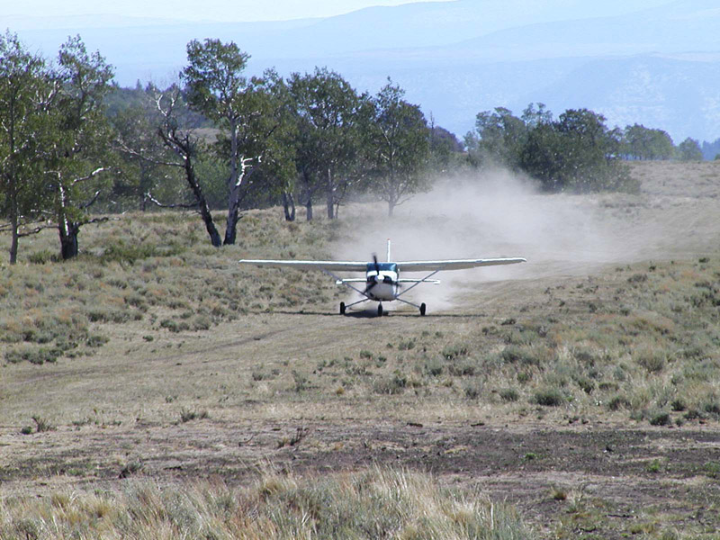
There may be livestock on the runway.
 During
a trip to New Mexico I stopped at the Reserve location of
the USFS and inquired about the airstrip. You can drive to
it in about an hour and a half, down a dusty dirt road. This
airstrip is During
a trip to New Mexico I stopped at the Reserve location of
the USFS and inquired about the airstrip. You can drive to
it in about an hour and a half, down a dusty dirt road. This
airstrip is listed as private, but people go in and out all the time.
The USFS will probably grant you permission.
listed as private, but people go in and out all the time.
The USFS will probably grant you permission.
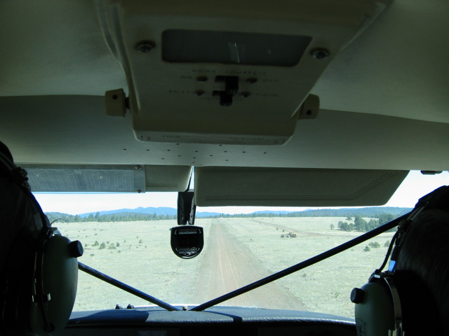
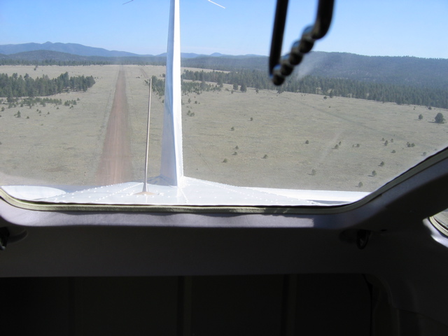
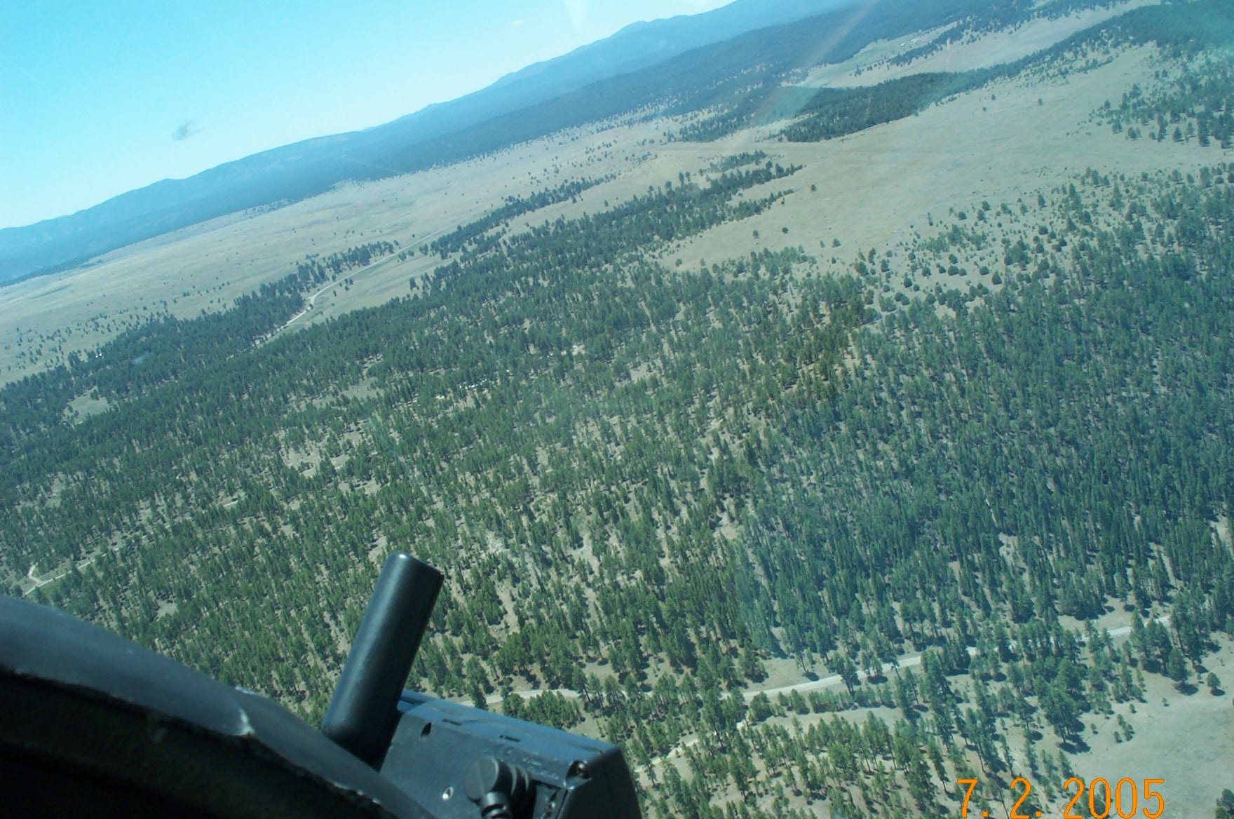
Takeoff runway 17
Landing runway 35
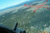
 Photos
by Christopher Martindell - When I took the pictures I
was out there doing a study for the Air Force and was based
there for four months every summer for three years. The USAF
wanted to lower their VR route through there and in order to
do so they needed to do an Environment Impact Study. I am an
ex-SONARMAN on Los Angeles-class submarines. I was hired to
go there to make the acoustical measurements of the over
flights and then submit them to the biologists to do their
study. It was fun. I don't think the Air Force or the Air
National Guard is going to stop flying through the area
anytime soon, so watch out for F-16s, T-38s and German
Tornados screaming through the Gila National forest at 500
feet or lower and around 500 knots. They also have F-117s
flying the route at night and I've seen a couple of C-130s
fly the route. It's fun when they have to gain altitude so
they can bank without their wings hitting the ground, then
drop back down after their turn. Their route is several
miles south of the airstrip, but keep an eye out. They are
trained to try to avoid it due to fire-fighting traffic. Photos
by Christopher Martindell - When I took the pictures I
was out there doing a study for the Air Force and was based
there for four months every summer for three years. The USAF
wanted to lower their VR route through there and in order to
do so they needed to do an Environment Impact Study. I am an
ex-SONARMAN on Los Angeles-class submarines. I was hired to
go there to make the acoustical measurements of the over
flights and then submit them to the biologists to do their
study. It was fun. I don't think the Air Force or the Air
National Guard is going to stop flying through the area
anytime soon, so watch out for F-16s, T-38s and German
Tornados screaming through the Gila National forest at 500
feet or lower and around 500 knots. They also have F-117s
flying the route at night and I've seen a couple of C-130s
fly the route. It's fun when they have to gain altitude so
they can bank without their wings hitting the ground, then
drop back down after their turn. Their route is several
miles south of the airstrip, but keep an eye out. They are
trained to try to avoid it due to fire-fighting traffic.
As far as the airstrip goes, it's a
pretty easy in and out. It's just the density altitude you
have to watch, but there is plenty of room to get up to
speed. I rode in and out of there a couple of times in a
Cessna 206 and Cessna 185 when some missionaries were using
the airstrip to practice what it will be like flying
supplies to unimproved strips in Africa. Runway 17 has a
slight uphill slope. Unless there is a strong crosswind the
best approach is from the south to runway 35. The ideal
departure is to the south on runway 17. There is a little
dip in the runway that might kick the plane in the air
prematurely.
I live in San Diego and fly from MYF.
I'm always looking for fun places to fly that are close
enough for a one-day trip out and back and this one matches
the criteria. I really enjoy your site and hope you keep
updating it. Thanks.
Elevation
This beautiful Wyoming airstrip is located
about 10-nautical miles south of the Otter Creek Ranch. It
is open and well maintained by its owner, Robert Orchard.
Mr. Orchard is a delightful gentleman and we had quite a
conversation about flying in his area.
The airstrip has a single 3,000 foot by 50
foot turf runway that runs through a large grass-covered
plain. There are several obstacles on the west side of the
airport including a power line that runs the length of the
airstrip and a T-hangar that sits about halfway down the
runway. He also said there is a road that intersects the
airstrip on the southwest side at a 20- to 30-degree angle.
If the landing rollout needs to be extended the airplane
could turn and use the road as a runway providing the speed
is not excessive.
Mr. Orchard has a Maule STOL plane based at
the field that he uses daily for herding cattle around the
enormous ranch.
The approach to runway 04 and runway 22 are
wide open and there is a good windsock located 300 feet
south of the hangar.
If you would like to land there Mr. Orchard
has no problem, but he asks that you call first before
landing due to gopher hole or other adverse surface
conditions.
Robert Orchard 307-366-2450
Elevation
03WY Located about 10 miles
southeast of the tiny Wyoming town of Ten Sleep, the Otter
Creek Ranch airstrip lies in the middle of thistle weeds.
The airstrip is still considered open but is no longer used
by its owners, nor is it maintained in a usable condition.
The strip sits on a 70,000-acre cattle ranch
according to manager Dennis Johnson. We visited in January
2004 and he said the strip has not been used in three or
four years. He has no problem with us listing it. A very
nice cowboy.
The layout is interesting. The strip has
three runways varying in length from 1,100 feet to 2,500
feet. This type of runway configuration is generally
reserved for airstrips where the wind can (and often does)
blow from any direction. I traveled through Ten Sleep in May
2002 and can imagine the wind blowing from different
directions. The strip is south of town and east of the Big
Horn Mountains. The terrain is mostly high grasses.
Mr. Johnson made a comment that a "pilot may
be able to get down on the strip during the summer months,
depending on whether or not it's been mowed." The strip is
difficult to locate in its current condition because it
looks like nothing more than a regular field.
Go have a look, but it is private. If you
want to touch down call Mr. Johnson at 307-366-2447.
Elevation 1,800
OR12 No specific
information can be found. All phone numbers failed, but the
runway is 17/35, 2,900 feet by 50 feet asphalt. The airport
is located in a deep, narrow canyon just north of the Oxbow
Dam. The airstrip is about 15 miles south of Memaloose.
Elevation approximately 4,000
Pasayten Airstrip was built i the early
1930s by the CCC (Civilian Conservation Corp) that was
created by President Franklin D. Roosevelt to provide jobs
for thousands of workers during the Great Dlepression.
The airstrip was used primarily for fire
suppression operations for many years. The strip itself is
very good for backcountry standards. It is nearly 4,000 feet
in length and at least a couple of hundred feet wide. The
runway lies along a bench above the Pasayten River in the
Okanagon National Forest. The strip was closed when the
government passed a forest preservation act in 1968. It has
remained closed since that time.
The USFS maintains a cabin at the airstrip
and they will fine you if you fly into this airstrip.
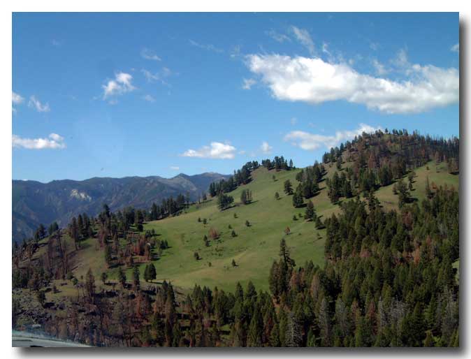
The surrounding terrain was ravaged by a
forest fire in the 1920s and has new growth pine forest.
Elevation 6,800
68CN The airstrip is
currently suitable for emergency use only. The owner is
unavailable for contact as was the owner of the near by
Sacatar Meadows airstrip.
Do not land here unless you have secured
permission.
Possum Creek – Glenwood Springs, Colorado
Private / David Force, Jr.
Elevation 10,010
 Possum
Creek could well be the Nation's highest airstrip. The
runway is 1,360 feet long, but It has a 30-percent uphill
slope. The runway starts at an elevation of 9,840 feet. At
each end of the strip is a 700-foot cliff. To land here you
must first get permission from Mr. Force. Possum
Creek could well be the Nation's highest airstrip. The
runway is 1,360 feet long, but It has a 30-percent uphill
slope. The runway starts at an elevation of 9,840 feet. At
each end of the strip is a 700-foot cliff. To land here you
must first get permission from Mr. Force.
The area, including the airstrip, may have
been sold on 03-17-2003.
Photo by Kay Cooper
    Photos
by Sparky Imeson, 04-02-2003 Photos
by Sparky Imeson, 04-02-2003
|